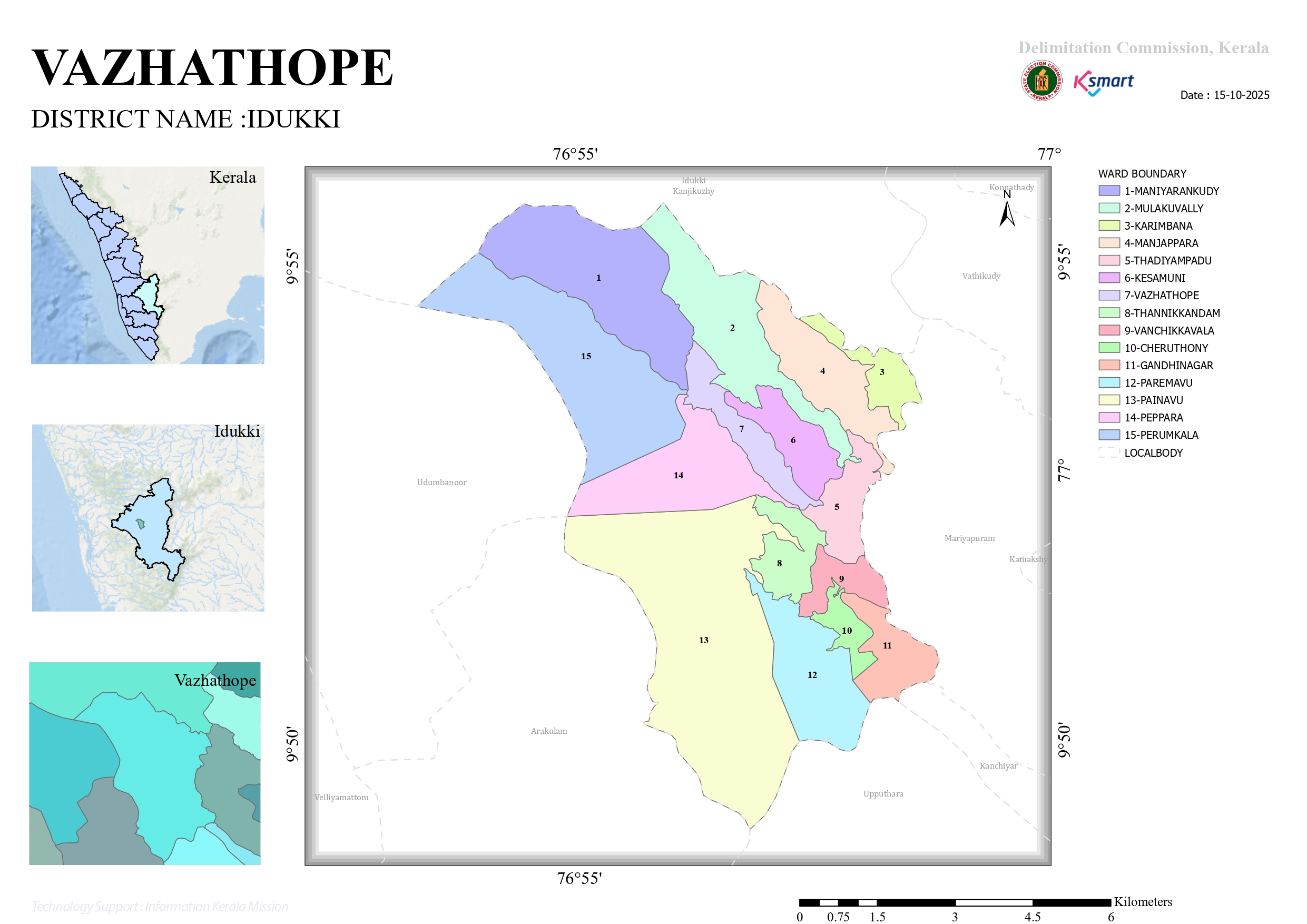
Panchayat Map 2026
Vazhathope Grama Panchayat is located in Idukki district in the high ranges of Kerala and forms part of the Western Ghats mountain region. The Panchayat is characterized by hills, valleys, forests, reservoirs, and a cool high-range climate.
Major Geographical Features
- Highland Terrain:
Most parts of Vazhathope lie in elevated highland areas with steep slopes, rocky hills, deep valleys, and undulating terrain. - Climate:
The region receives heavy rainfall and usually experiences a cool and misty climate because of its high-altitude location in the Western Ghats. - Forests and Natural Vegetation:
Earlier, the area was densely forested and inhabited mainly by tribal communities and nomadic groups dependent on forest resources. - Reservoirs and Dams:
Vazhathope is geographically important because it includes parts of the famous Idukki Dam reservoir system. Two of the three dams connected with the Idukki Hydroelectric Project are located within the Panchayat region. - Rivers and Water Resources:
The area is connected with river systems and reservoir catchments associated with the Periyar basin and nearby streams flowing through valleys and hilly regions. - Agricultural Landscape:
Agriculture is one of the main geographical and economic features. Crops cultivated include:- Rubber
- Pepper
- Cocoa
- Coffee
- Ginger
- Paddy and tapioca (earlier period)
- Biodiversity:
Due to the forested high-range environment, the Panchayat has rich biodiversity, natural vegetation, and wildlife habitats typical of the Western Ghats ecosystem.
Location Features
- Located near Painavu, the district headquarters of Idukki.
- Connected through hilly roads and high-range transport routes.
- The Panchayat area includes important administrative and institutional centers related to Idukki district.
In Summary
The geography of Vazhathope Panchayat is mainly defined by:
- mountainous terrain,
- high rainfall,
- forests,
- reservoirs and dams,
- agricultural plantations,
- and the scenic landscape of the Western Ghats.
These geographical features strongly influence the Panchayat’s agriculture, climate, settlement pattern, tourism potential, and overall rural development.
Vazhathope Grama Panchayat is a Grama Panchayat located in Idukki district of Kerala. It is situated in the high-range region near Painavu and Cheruthoni.
Map and Location Details
- Located near:
- Painavu
- Cheruthoni
- Cheruthoni Dam
- Geographic coordinates:
- Latitude: 9.87532° N
- Longitude: 76.95913° E
- Administrative details:
- LGD Code: 221155
- Total wards: 14
Official and Interactive Map Resources
- ward boundaries,
- roads and settlements,
- nearby dams and reservoirs,
- rivers and hills,
- administrative offices,
- and major public institutions.